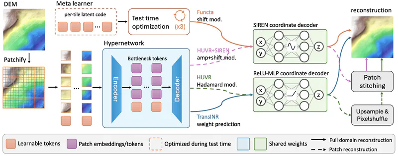
Rethinking Amortized Neural Representations for High-Resolution Terrain Elevation Data
A controlled benchmark of amortized neural representations on high-resolution (1 m/pixel) terrain elevation data, and HUVR+SIREN — a hypernetwork with a smooth, analytically differentiable decoder that attains the best height and derivative fidelity with no extra per-tile storage.
Nov 3, 2026
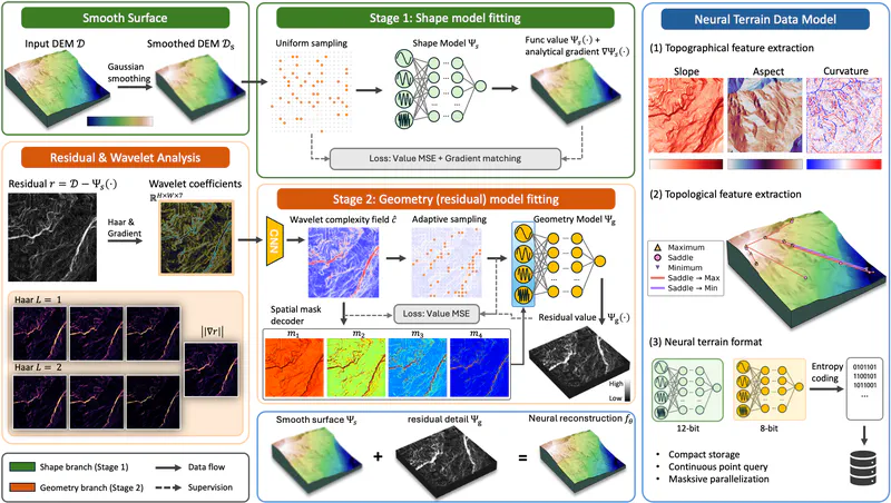
ImplicitTerrainV2: Wavelet-Guided Spatially Adaptive Neural Terrain Representation
A wavelet-guided, spatially adaptive implicit neural representation for digital elevation models. A wavelet complexity field localizes high-frequency capacity to complex terrain, and post-training compression reaches 1.23 bpp — 66.25 dB PSNR on Swiss terrain tiles, +5.70 dB over prior work with 3.2x fewer parameters.
Nov 3, 2026