Critical Features Tracking on Triangulated Irregular Networks by a Scale-Space Method
Abstract
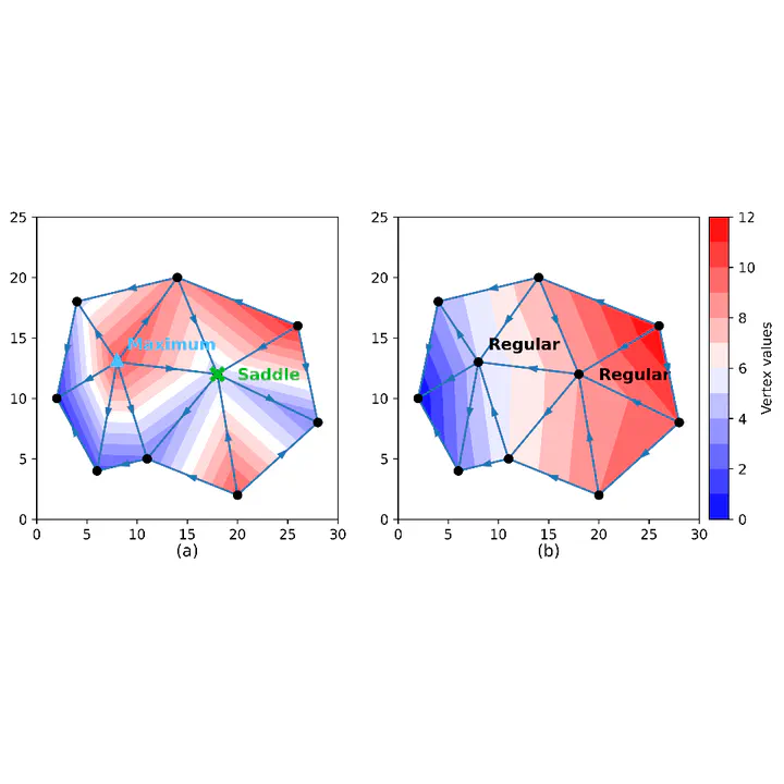
The scale-space method is a well-established framework that constructs a hierarchical representation of an input signal and facilitates coarse-to-fine visual reasoning. Considering the terrain elevation function as the input signal, the scale-space method can identify and track significant topographic features across different scales. The number of scales a feature persists, called its life span, indicates the importance of that feature. In this way, important topographic features of a landscape can be selected, which are useful for many applications, including cartography, nautical charting, and land-use planning. The scale-space methods developed for terrain data use gridded Digital Elevation Models (DEMs) to represent the terrain. However, gridded DEMs lack the flexibility to adapt to the irregular distribution of input data and the varied topological complexity of different regions. Instead, Triangulated Irregular Networks (TINs) can be directly generated from irregularly distributed point clouds and accurately preserve important features. In this work, we introduce a novel scale-space analysis pipeline for TINs, addressing the multiple challenges in extending grid-based scale-space methods to TINs. Our pipeline can efficiently identify and track topologically important features on TINs. Moreover, it is capable of analyzing terrains with irregular boundaries, which poses challenges for grid-based methods. Comprehensive experiments show that, compared to grid-based methods, our TIN-based pipeline is more efficient, accurate, and has better resolution robustness.
Type
Publication
In The 32nd ACM International Conference on Advances in Geographic Information Systems (SIGSPATIAL ’24). (Oral Presentation)
You can find the slides and a 15 mins presentation on the project page
.